oxygen domain was triggered too early. This is usually an indicator for some code in the plugin or theme running too early. Translations should be loaded at the init action or later. Please see Debugging in WordPress for more information. (This message was added in version 6.7.0.) in /home/rdunsire/public_html/wp-includes/functions.php on line 6260wordpress-seo domain was triggered too early. This is usually an indicator for some code in the plugin or theme running too early. Translations should be loaded at the init action or later. Please see Debugging in WordPress for more information. (This message was added in version 6.7.0.) in /home/rdunsire/public_html/wp-includes/functions.php on line 6260Mazingarbe is located in Pas de Calais in northern France.
It is approximately 60 miles from the coast at Calais.
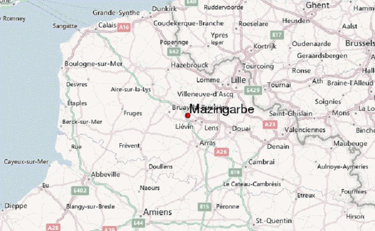
Modern Map highlighting location of Mazingarbe in Pas de
Calais, Northern France
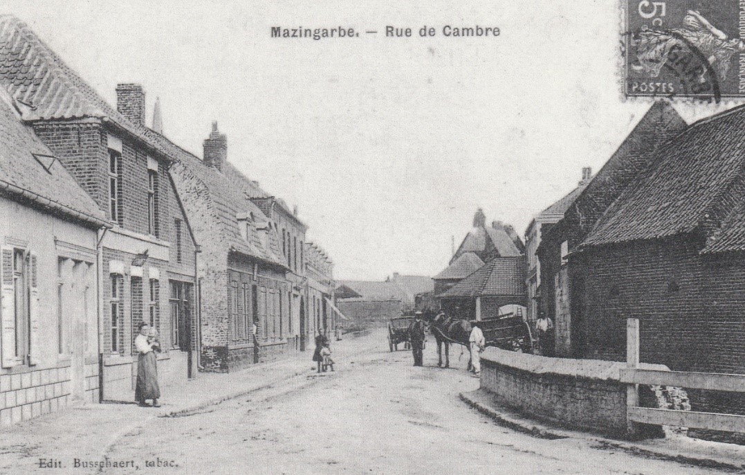
On the eve of the World War I, Mazingarbe was mostly an
agricultural village, with its buildings (farms, trading houses and craft
workshops) built with chalk, bricks and clay cob. It also provided
accommodation for local miners.
With the discovery of coal around the village, workers’
houses were built near mining pits 2, 3, 6 and 7 belonging to the Béthune
Mining Company, and by 1911, the population had grown to 6,110 inhabitants.
On 15 January 1853, the Béthune Mining Company was awarded
the Grenay concessions that covered an area of 5,761 hectares, (22.2 square
miles). By 1859, the first mine shaft (designated 2) was opened in the
neighbouring village of Bully-les- Mines. Pit 6 followed in 1876, then Pit 7 in
1877, both within the boundaries of Mazingarbe. Pit 3 opened on the
Béthune–Lens Road. A local coal-processing plant had also been established by
1896.
The following map illustrates the distribution of the
Company’s pits in the area around Mazingarbe before the outbreak of World War
1.
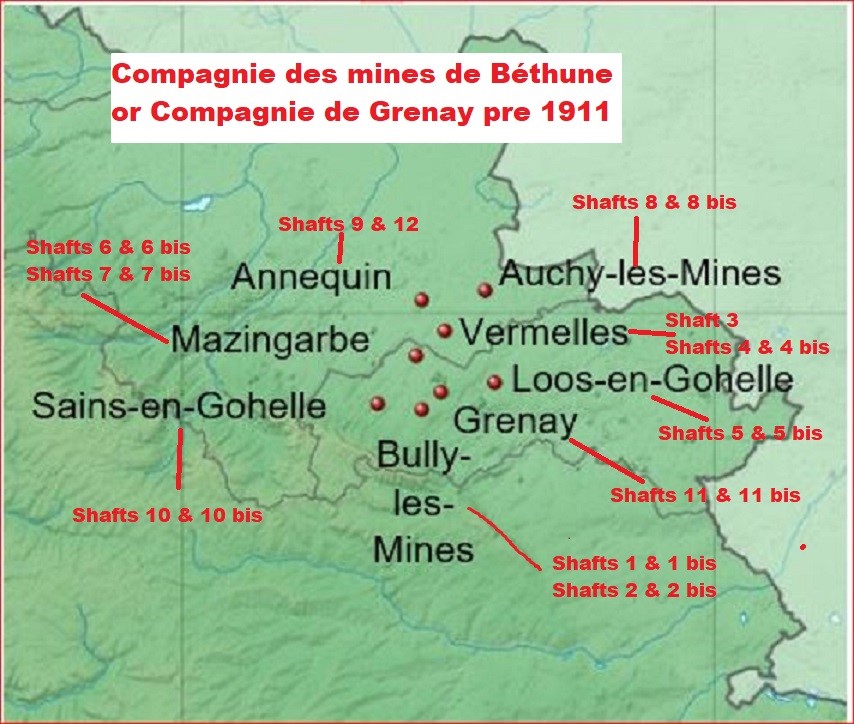
Attr: Eric Gaba, Wikimedia Commons user Sting
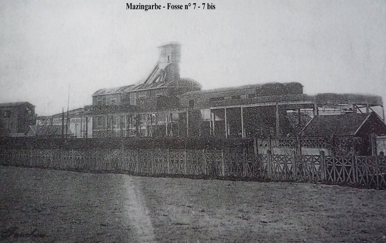
Fosse 7 – 7b Attr: Unknown author, Public domain, via
Wikimedia Commons
Like Denbeath in Fife, where Robert lived after his
marriage, housing (corons) was built to accommodate the new communities of mine
workers, which also signalled the arrival of foreign workers. The first wave
arrived from the Belgian mining area of Hainaut in Wallonia, on the border with
northern France, who had been the victims of intolerance during periods of
industrial unrest at the turn of the nineteenth and twentieth centuries.
The church was built in the middle of the nineteenth century
using the ogival style of the thirteenth century. The ogival, or pointed, arch
is a defining design element of Gothic architecture. and this style features
magnificently in the church at Mazingarbe.
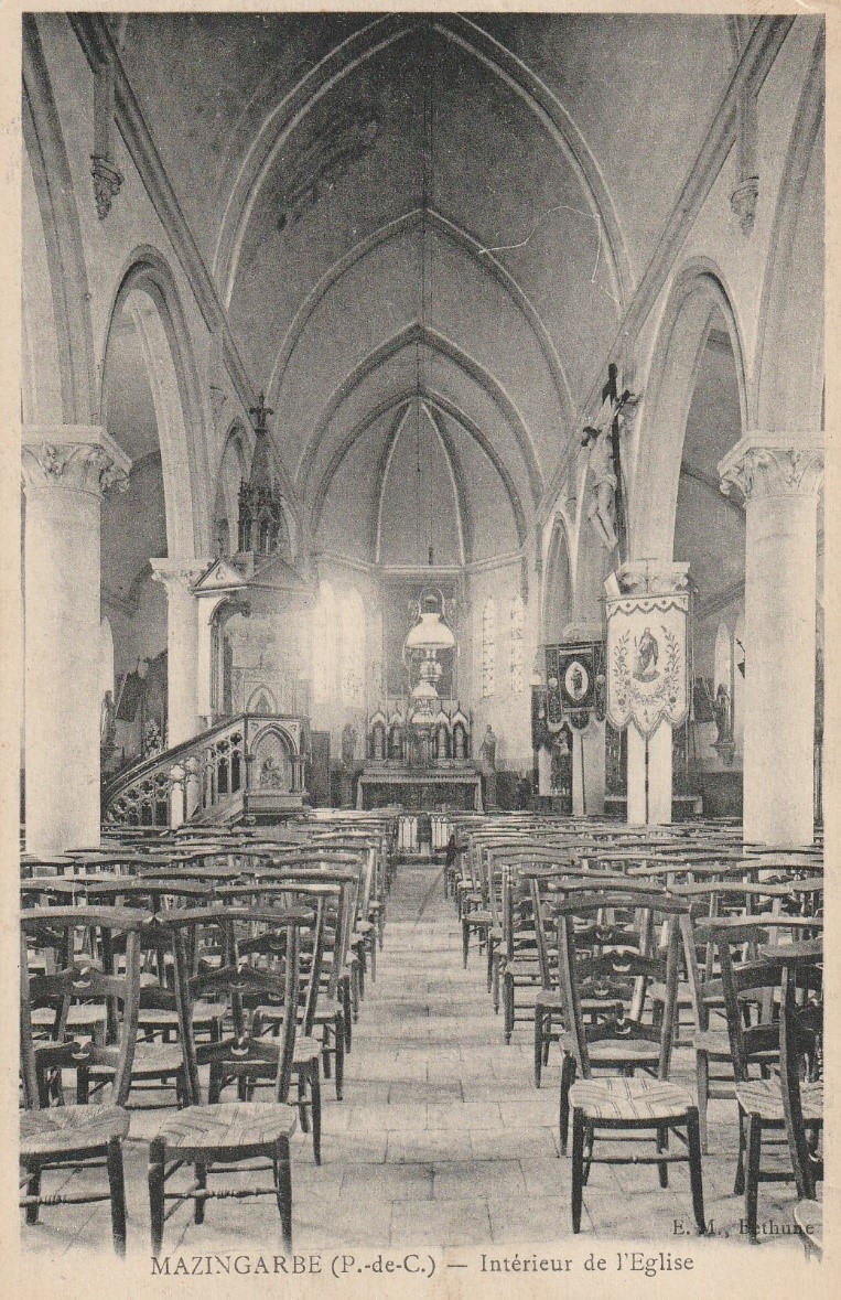
Image Courtesy of Comité Historique Mazingarbe
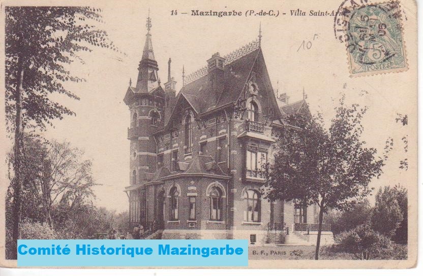
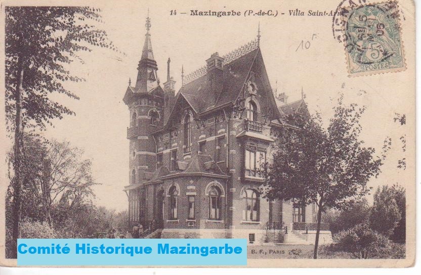
Mazingarbe had many grand buildings, e.g, Château Saint
Arnold, that were to be used by British troops during periods such as the
Battle of Loos.
Modern Map highlighting location of Mazingarbe in Pas de
Calais, Northern France
On the eve of the World War I, Mazingarbe was mostly an
agricultural village, with its buildings (farms, trading houses and craft
workshops) built with chalk, bricks and clay cob. It also provided
accommodation for local miners.
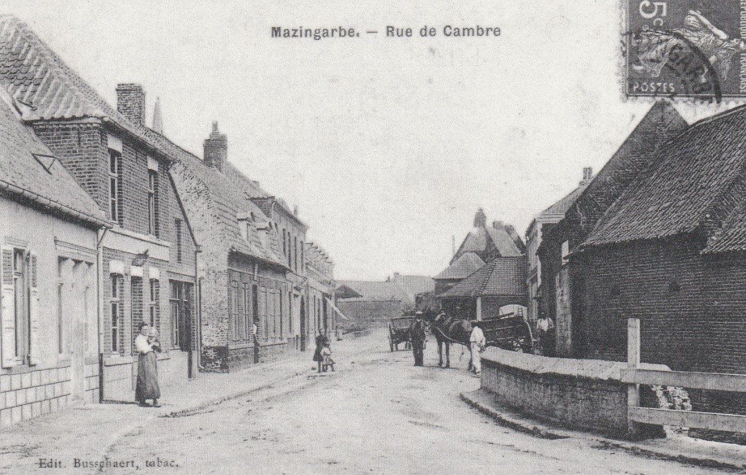
Image Courtesy of Comité Historique
Mazingarbe
With the discovery of coal around the village, workers’
houses were built near mining pits 2, 3, 6 and 7 belonging to the Béthune
Mining Company, and by 1911, the population had grown to 6,110 inhabitants.
On 15 January 1853, the Béthune Mining Company was awarded
the Grenay concessions that covered an area of 5,761 hectares, (22.2 square
miles). By 1859, the first mine shaft (designated 2) was opened in the
neighbouring village of Bully-les- Mines. Pit 6 followed in 1876, then Pit 7 in
1877, both within the boundaries of Mazingarbe. Pit 3 opened on the
Béthune–Lens Road. A local coal-processing plant had also been established by
1896.
The following map illustrates the distribution of the
Company’s pits in the area around Mazingarbe before the outbreak of World War
1.
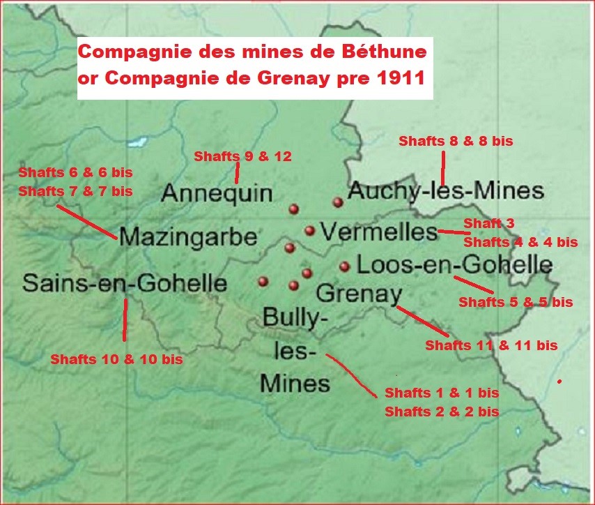
Attr: Eric Gaba, Wikimedia Commons user Sting
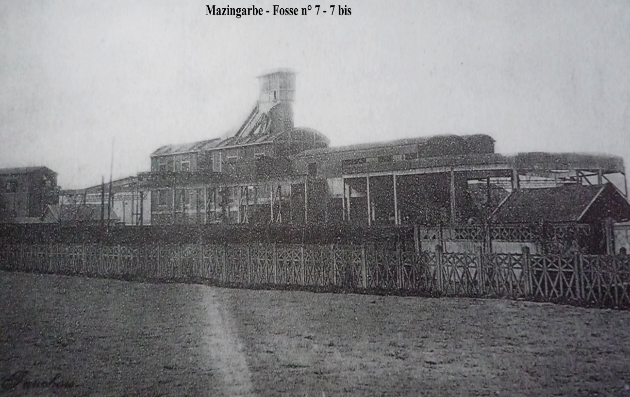
Fosse 7 – 7b Attr:Unknown author, Public domain, via Wikimedia Commons
Like Denbeath in Fife, where Robert lived after his
marriage, housing (corons) was built to accommodate the new communities of mine
workers, which also signalled the arrival of foreign workers. The first wave
arrived from the Belgian mining area of Hainaut in Wallonia, on the border with
northern France, who had been the victims of intolerance during periods of
industrial unrest at the turn of the nineteenth and twentieth centuries.
The church was built in the middle of the nineteenth century
using the ogival style of the thirteenth century. The ogival, or pointed, arch
is a defining design element of Gothic architecture. and this style features
magnificently in the church at Mazingarbe.
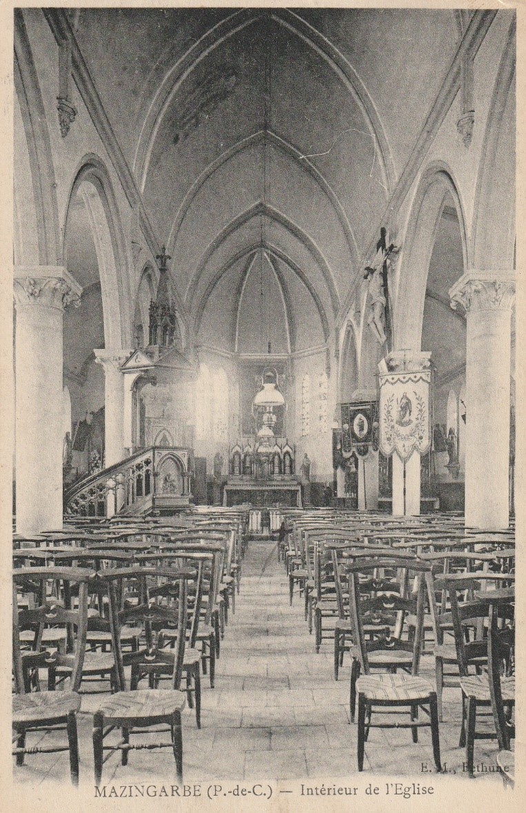
Image Courtesy of Comité Historique Mazingarbe
Mazingarbe had many grand buildings, e.g., Château Saint
Arnold, that were to be used by British troops during periods such as the
Battle of Loos.